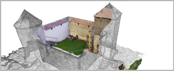
Photogrammetry
Drone photogrammetry allows to generate a 3D model of land or a building with precise geolocalisation.
It is used in many fields, it allows to measure distances and to calculate surfaces or volumes directly on the 3D model.
Our partners:


Drone photogrammetry
120 Sites modelled since 2012
Our teams have worked on modelling of different subjects such as industrial sites, heritage sites, historic sites, quarries, stock of materials… These different aerial modelling frameworks have enriched our expertise and ensure precise 3D reconstructions. Your renderings will be viewable and usable directly on our dedicated web platform.
- ^INTERVENTION IN EUROPE
- ^MORE THAN 300 CUSTOMERS
- ^DGAC / PREFECTURE / ARMY AUTHORISATION
years of experience
Teams trained and qualified in expert modelling software
Our expertise
The different application areas of aerial photogrammetry
3D MODELLING
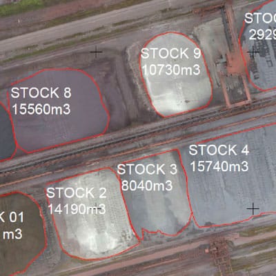
VOLUME CALCULATION (CUBATURE)
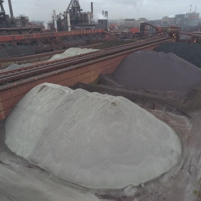
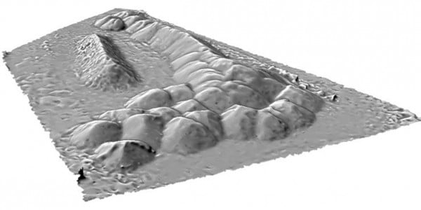
Thanks to its level of precision, aerial photogrammetry allows very reliable surface and volume calculations.
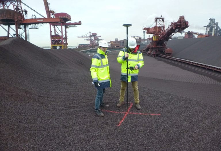
Furthermore, this technique is often used in the context of mining and quarrying to inventory and monitor stocks. Earthmoving companies use it regularly to monitor construction sites and assess cuttings or embankments.
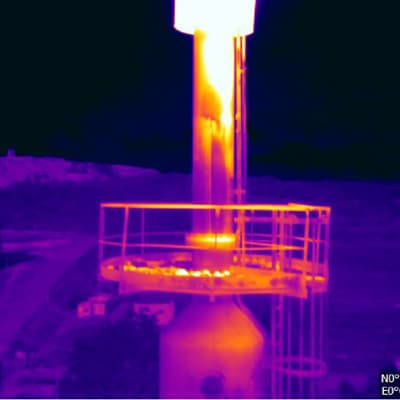
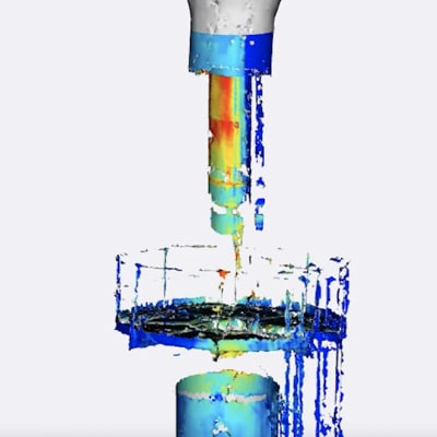
3D THERMAL MODELLING
METHODOLOGY
Drone modelling process
Specifications
Characterisation of your expectations related to the accuracy of the model.
On-site capture
Creation of a secure area, flight plan, photogrammetry.
Exploitation of renderings

High-definition shots
Questions about your subject to model?
What is drone photogrammetry ?
Increased accuracy thanks to geolocalisation
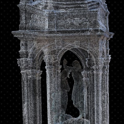
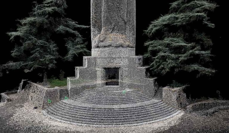
The use of a GPS RTK allows to georeference each photographed pixel in relation to fixed points whose coordinates are determined with extreme precision. Reality is first represented in the form of a very dense cloud of points, whose coordinates are calculated with respect to these fixed points. After processing by a very powerful specialised software, we obtain a very realistic 3D modelling with high precision.
- 520 to 50 million pixel sensor
- 5Rainproof IP43-certified drone
- 5Flight time between 20 and 45 minutes
- 5Secure web platform
- 5Sharing renderings by simple link
- 5GSD up to 0.1cm/px
- 5Thermal conductivity
FAQ
Aerial photogrammetry
Frequently Asked Questions
What is photogrammetry ?
 3D modelling by photogrammetry can be qualified as “3D Capture” and allows to identify a three-dimensional structure, a surface condition or a disaster site. Our drone capture process opens up new possibilities for many industries.
Drone photogrammetry is an innovative and powerful tool for study, analysis and communication.
3D modelling by photogrammetry can be qualified as “3D Capture” and allows to identify a three-dimensional structure, a surface condition or a disaster site. Our drone capture process opens up new possibilities for many industries.
Drone photogrammetry is an innovative and powerful tool for study, analysis and communication.
What applications for photogrammetry ?
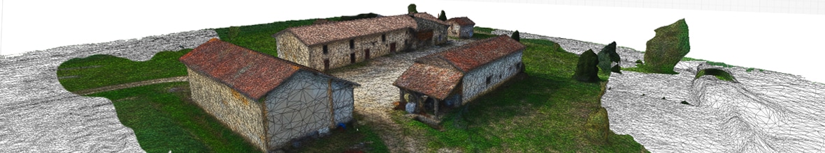
In partnership with 3D modellers, we combine drone technology with this 3D reconstruction process and have developed a capture and processing methodology allowing us to model large buildings or large infrastructures.
We are already working with several architectural firms. Drone photogrammetry has many applications. We develop with our customers solutions adapted to each project.
APPLICATION BY SECTOR
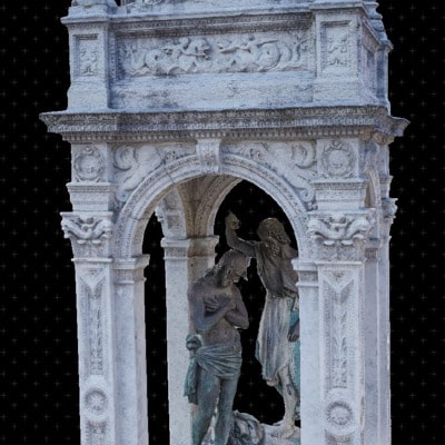
- INHERITANCE : Interactive models of buildings, renovations, modelling of cornices, statues.
- CONSTRUCTION : Cubages, land surveys, land elevation models.
- GEOLOGY : Textured modelling of reliefs, cliffs, crevices.
- ARCHEOLOGY : 3D modelling by drone in preventive archaeology.
How is the data acquisition carried out?
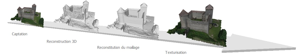
 During data acquisition, capture is done from pre-determined angles. Our software solution uses the parallax between these different points of view to reconstruct the geometry of the volume studied, and a texturisation function allows a “blending” between the photos to produce a real rendering.
 Our 3D drone modelling technique is in a way a “3D photograph” of your installation.
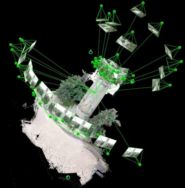
 The method of acquiring a sequence of photographs for photogrammetric modelling requires practice and a real methodology. We use this or that flight and triggering scenario depending on the morphology of the volume to model, and we adapt the equipment used.
Our software solution first allows us to position the views in space, and to perform a point correlation between the different photographs.
The three-dimensional modeling is carried out through drone-assisted photogrammetry, a tailor-made planned flight path, and 360° coverage of the monument, building or space of implantation.
The method of acquiring a sequence of photographs for photogrammetric modelling requires practice and a real methodology. We use this or that flight and triggering scenario depending on the morphology of the volume to model, and we adapt the equipment used.
Our software solution first allows us to position the views in space, and to perform a point correlation between the different photographs.
The three-dimensional modeling is carried out through drone-assisted photogrammetry, a tailor-made planned flight path, and 360° coverage of the monument, building or space of implantation.How is the data processed and for what rendering?
 The resulting mesh is then textured and corrected by our 3D modellers. We then export it in different formats depending on the intended use: Autodesk, Collada, VRML, Obj, RZI, IPM, etc… This model can then be scaled 1:1. It will then be usable for direct measurement: dimensions, surfaces and volumes. We support you if you wish to perform a calculation of cubatures, an evaluation of volumes of cuttings, embankments or if you wish to obtain the level curves of a land.
 For an aerial inspection by drone of a building or surface (e.g., façade under renovation), the choice of 3D allows to present the planned works very effectively, for example.
For a “visual” application of your 3D drone modeling, we offer different types of renderings:
For an aerial inspection by drone of a building or surface (e.g., façade under renovation), the choice of 3D allows to present the planned works very effectively, for example.
For a “visual” application of your 3D drone modeling, we offer different types of renderings:
- Integration of the model on your website
- Video animation integrating the model

- 8, rue de la Madeleine - 69007 LYON
- 04 37 28 67 25
- contact@studiofly.fr