Drone and photogrammetry
DRONE ORTHOPHOTOGRAPHY
High-definition mapping.


Drone orthophotography
Accurate mapping of large areas
Drone orthophotography allows to map very large areas quickly and with very high definition and maximum precision. It is used in many fields such as agriculture, forestry, town planning, development, research, environmental or planning studies, etc.
Orthophotography methodology
What is drone orthophotography?
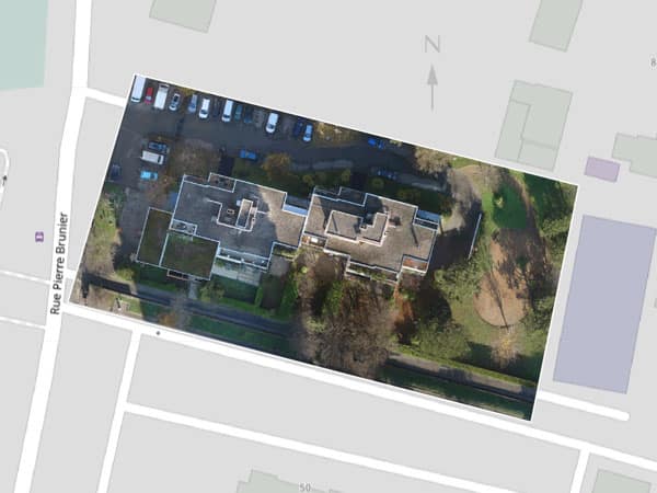
Assembly of an orthophotograph
Drone orthophotography is an assembly of very many high-resolution images taken during the overflight of an area. The drone is equipped with a high-definition camera. In some cases, a thermal camera can be added to create a thermal map.
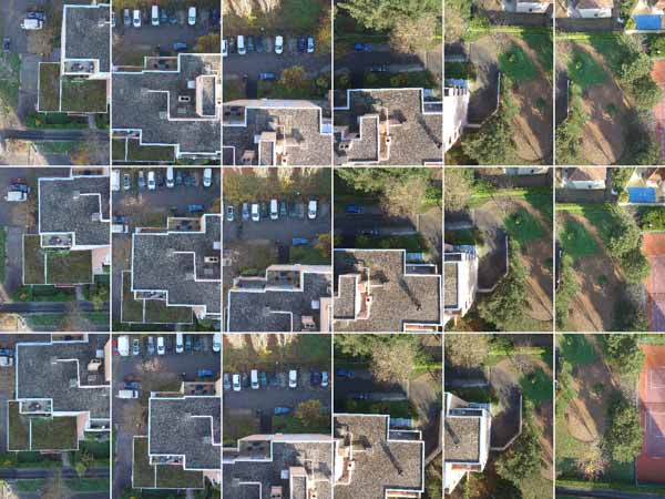
Aerial photographs are taken at low altitudes and from several angles. They overlap with each other according to a well-defined overlapping rate. All these parameters as well as the flight plan are adjusted according to the desired rendering quality and the characteristics of the area overflown.
Resolution and precision: focus on the strengths of aerial orthophotography
It is possible to achieve resolutions of only a few centimetres per pixel, but this impacts the cost. The level of definition is therefore set according to the use that the client intends to make of the maps.

Precision corresponds to the reliability of the georeferencing and therefore to the accuracy of the cartography produced.
The development of the map rendering
After acquiring the data in the field, specialised post-processing software allows us to stitch all the photos. Defects and distortions are corrected and the final image is orthorectified.
The high-definition cartography thus developed is made available to you directly on a dedicated web application.


What is an aerial orthophotograph used for?
Our online mapping system allows you to perform these operations easily, without having to invest in expensive software.
Application of orthophotography
Ideas for applications of drone orthophotography
Agricultural monitoring

Mapping of the natural environment

Research organisations, archaeologists, geologists, environmental design offices and services responsible for the management of natural environments also use aerial orthophotography.
The high quality of the rendering allows in particular to :
- 5Follow the evolution of the dunes
- 5Identify and count plant or animal species
- 5Monitor the state of a water body in the event of pollution or invasion by water primrose or green algae
- 5Monitor the maintenance of hiking trails or cycle paths in the forest area
- 5Manage rivers and streams
Urban planning and land use planning

Drone orthophotography allows to develop or update the maps of urban planning services: POS, PLU…
Thermal mapping
In urban areas, thermal mapping helps to visualise the energy losses of buildings over a large area.
It is also used to update the mapping of underground heat networks.
Our expertise in drone mapping also extends to other areas of application :

- 8, rue de la Madeleine - 69007 LYON
- 04 37 28 67 25
- contact@studiofly.fr