Drone and photogrammetry
3D DRONE MODELLING
Three-dimensional representation, virtual capture of your field of activity.


3D drone modelling
3D digital model
3D modeling by drone consists of representing a building, a piece of land or a particular object, in the form of a 3-dimensional digital model, from images captured by a drone. This very precise virtual reconstruction of reality is used in many fields of activity.
3D modelling methodology
How do you do 3D modeling by drone?
Modeling by aerial photogrammetry
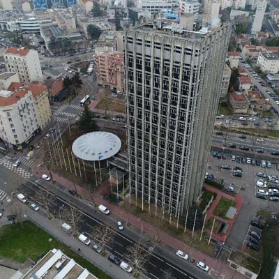
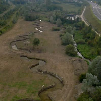
3D modeling by drone begins by flying over the area or object to be modeled at low altitude. The drone’s high-definition camera takes multiple shots from different angles. All are geolocalised to obtain a scale representation which will then allow precise measurements to be taken, and the calculation of areas and volumes.
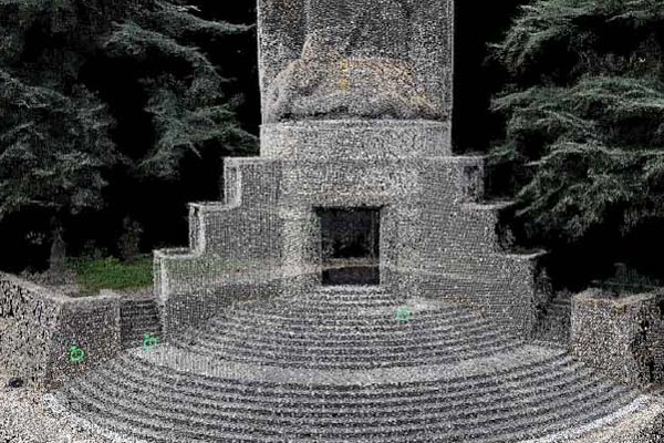
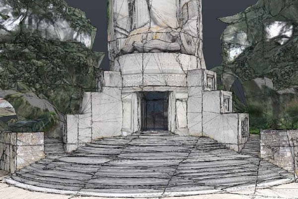

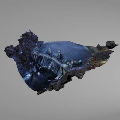
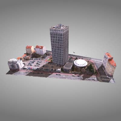
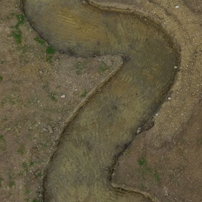
Following this image capture, software processing allows to model the subject in a dense cloud of points. For more details and realism, work is then done to improve the mesh between the points and texturize the whole. At the end of these operations, we obtain an ultra realistic model endowed with a very high definition.
The laser used from the ground as complementary to photogrammetry allows to refine the precision of the data by carrying out additional measurements on certain parts of a building.

We then export it to a hosting platform directly accessible via an internet link and equipped with tools to manipulate it.
Application of 3D modeling
The many uses of aerial 3D modeling
SPATIAL PLANNING
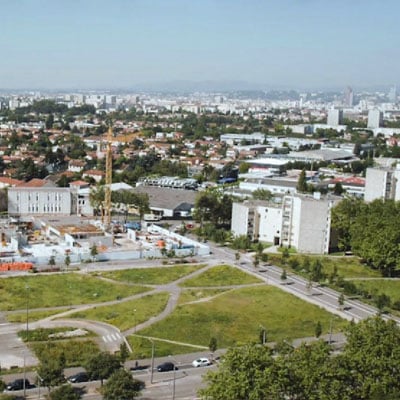
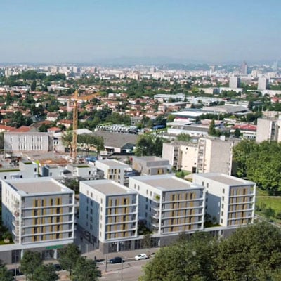
Private or public project owners use 3D modeling by drone to generate 3-dimensional maps of vast territories and integrate new developments, buildings or infrastructures.
PUBLIC WORKS
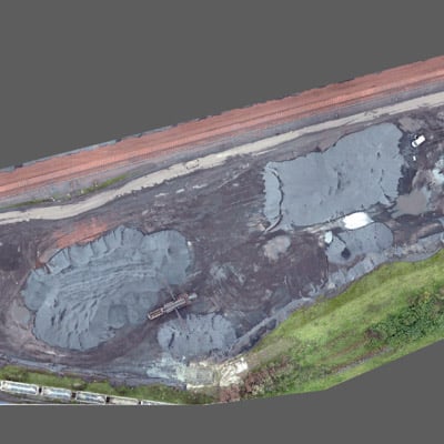
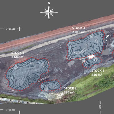
Aerial 3D modeling has become essential for large-scale construction sites. It allows to establish topographical surveys and to precisely calculate the volumes of materials to be cleared or brought back.
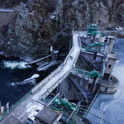
INFRASTRUCTURE MANAGEMENT AND MAINTENANCE
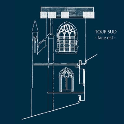
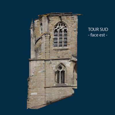
HERITAGE MANAGEMENT AND ENHANCEMENT
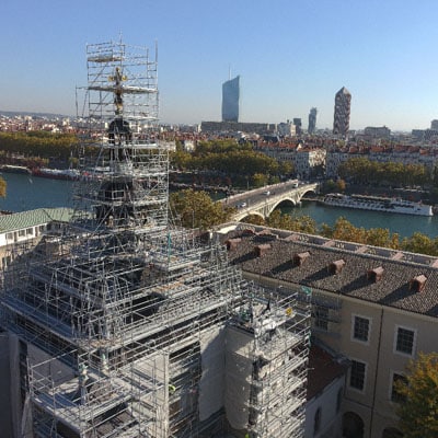
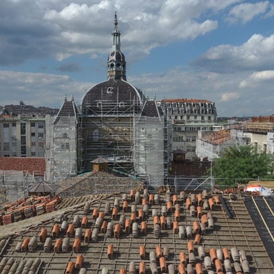
3D drone modeling of monuments allows to monitor the evolution of their condition and plan repair or maintenance work ahead.
SCIENTIFIC USES
RENOVATION OF BUILDINGS
The use of aerial modeling in the building allows to accurately estimate renovation work : quantities of materials, cost and scale of operations. But it is also used to ensure the feasibility of extending a building. It allows to check the dimensional aspect, to ensure the integration in the environment and to produce plans for the administrative authorisations.
MANAGEMENT OF VERY EXTENDED DOMAINS
3D modeling by drone of a golf course or a very large campsite can facilitate management. In particular, it allows to follow the evolution of the vegetation more easily and to rationalise the operations of landscape maintenance.
Our expertise in drone photogrammetry also extends to other areas of application :

- 8, rue de la Madeleine - 69007 LYON
- 04 37 28 67 25
- contact@studiofly.fr